 Himal Press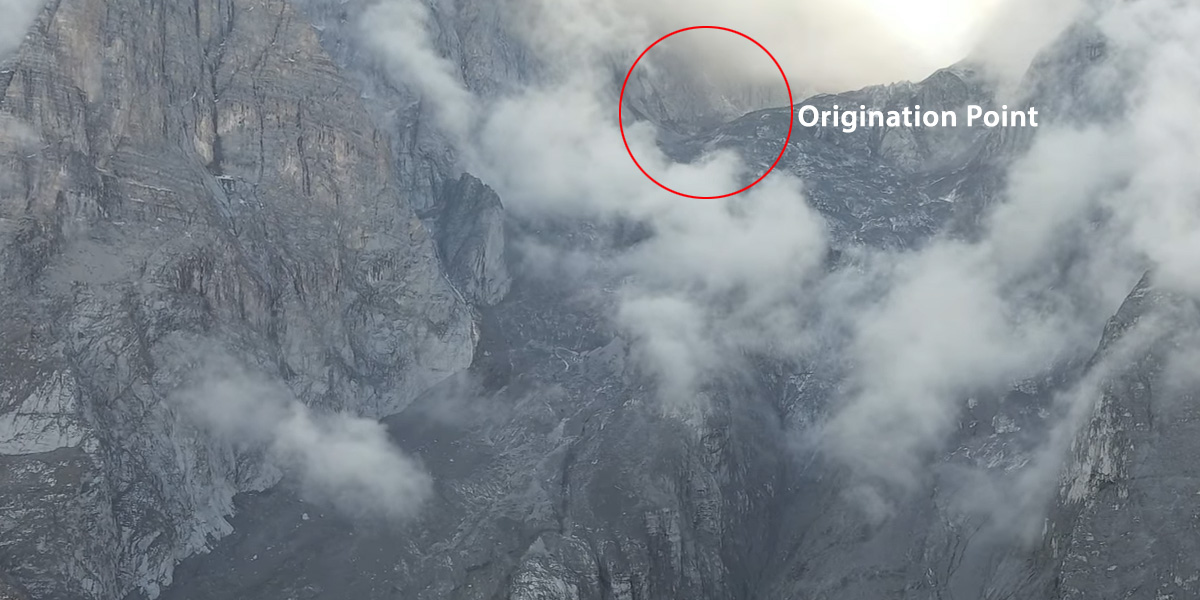
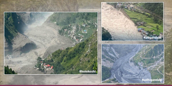
KATHMANDU: A massive landslide involving snow, water, glacier debris and rock triggered a series of destructive floods in the Budhigandaki River in northern Gorkha district on October 12, according to a technical assessment by the National Disaster Risk Reduction and Management Authority (NDRRMA).
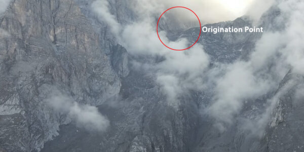
“It appears that an avalanche at an altitude of about 6,000 meters and a massive landslide containing a glacier (snow and debris) at an altitude of about 5,500 meters originated from the relatively weak rocks found in the Tibetan Tethys Himalaya in the high alpine region of the steep stream Chamar Himal and Syeranghi Himal,” the NDRRMA said in its preliminary technical assessment. “Smaller landslides occurred in the area both before and after the main event.”
According to the report, the mass of snow, water and debris flowed southward down the steep Ungdilung Khola, reaching as high as 300 meters along both banks. “A large volume of debris accumulated suddenly at the narrow confluence of the Ungdilung and Syarkhola rivers, at an altitude of around 2,000 meters, intermittently blocking and releasing the flow of the Syarkhola,” it said. “A similar process may have occurred at the confluence of the Syarkhola and the Budhigandaki River, triggering repeated flood surges downstream.”
The report identifies the massive volume of debris carried by the Ungdilung River as a more significant contributor to the flood surges than the water temporarily impounded behind the blockage in the Syarkhola.
The debris-laden flood first reached Salleri at around 4:30 am. The largest surge, which reached an estimated height of 20-25 meters, struck and swept away a hydropower camp in Salleri at around 6:30 am, according to the report.
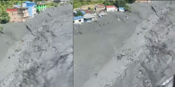
“The powerful surge caused major damage farther downstream, particularly in Jagat, where several buildings and infrastructure, including concrete bridges over the Sotikhola and the Budhigandaki rivers, were damaged or destroyed.
“Field observations indicate that the Syarkhola’s flow had stopped about an hour before the largest flood surge. Water had accumulated over a stretch of approximately 1.5 kilometers upstream of the blockage,” according to the report.
The report added that the flood contained a higher proportion of soil than sand and small and large rocks. “The high soil content gave the flow characteristics of a viscous mudflow, which moves more slowly than ordinary water-dominated floods but can carry substantial quantities of debris and cause extensive damage,” it added.
A preliminary assessment by the Department of Mines and Geology estimated that the landslide generated energy equivalent to that of a magnitude 3.5 earthquake.