 Himal Press
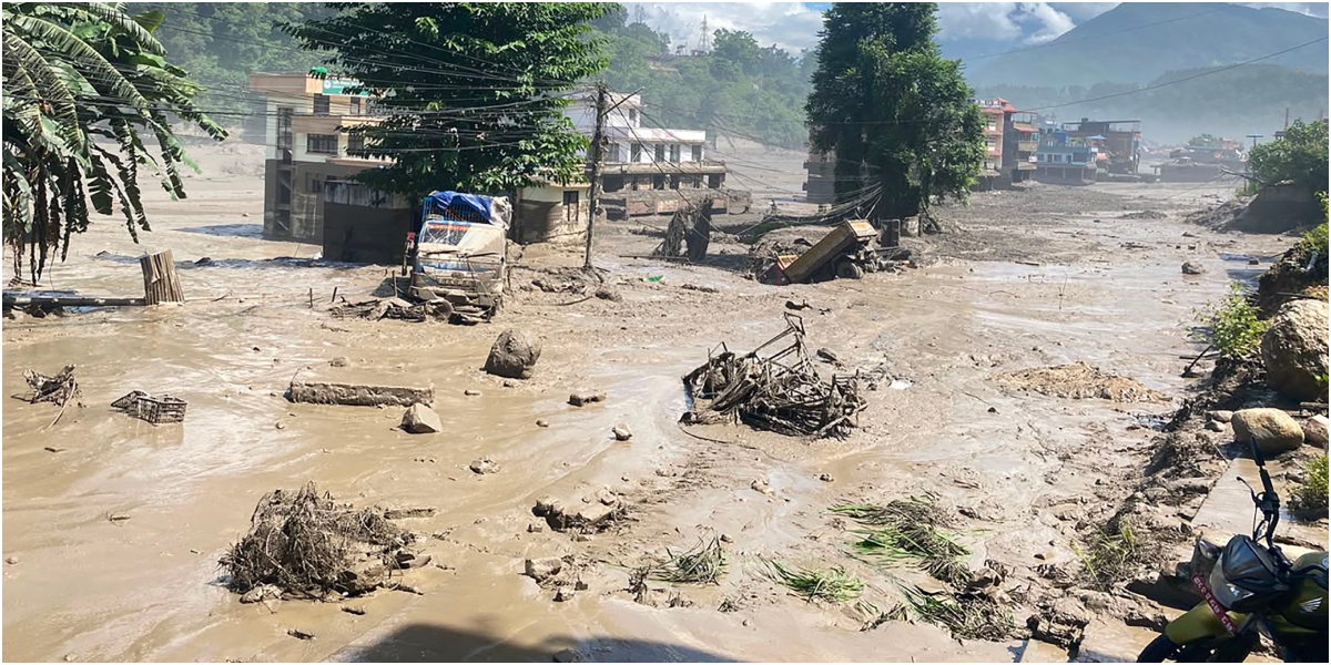
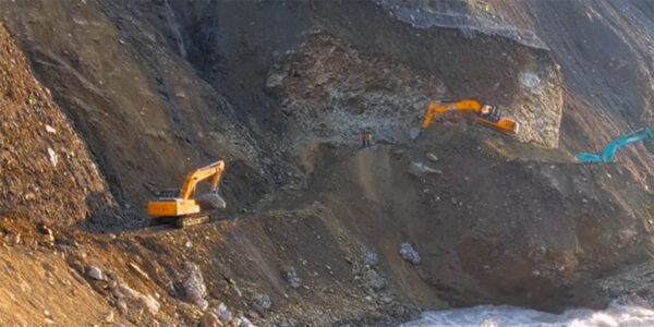
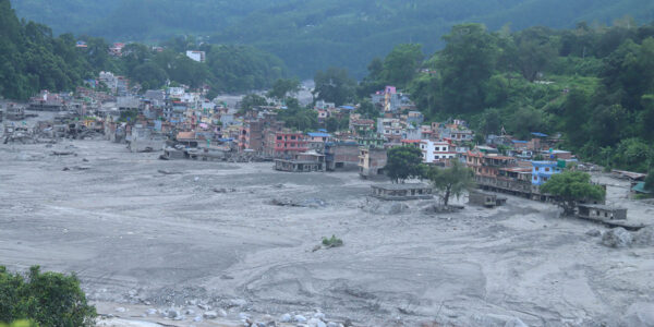
KATHMANDU: A landslide near Chumnubri in Gorkha on October 11 temporarily blocked a tributary of the Budhigandaki River. The accumulated water breached the natural dam, and the resulting flood swept away houses, suspension bridges, a road bridge connecting the district with Dhading and parts of a hydropower project under construction. At least five people are missing.
This was the second sudden flood in the Himalayan region in less than seven weeks. On August 26, a far more destructive flood struck the Nepal-Tibet border area in Rasuwa. Both disasters followed a similar pattern: a mountainside collapsed, blocked a river and eventually unleashed a devastating flood downstream.
The August 26 disaster caused extensive loss of life and property. More than 1,400 people died in Nepal, while over 5,000 are unaccounted for. Casualties were also reported in the Kerung area of China.
Preliminary studies suggest that a massive mass of rock and glacial ice fell into the Lhende River that flows along the Nepal-China border and formed a natural dam with accumulated debris. Water built up behind the barrier until it collapsed, sending a powerful flood downstream. The flood swept away roads, bridges, settlements and hydropower infrastructure. Many people trapped inside hydropower tunnels lost their lives.
These disasters raise a critical question: Can Himalayan catastrophes be explained solely as natural events, or are human activities also increasing the risks? Experts say Nepal needs to examine the potential implications of China’s expanding network of roads, tunnels, dams and hydropower projects in Tibet.
Since no direct causal link has been established between Chinese infrastructure development and the recent floods, blaming construction activities without sufficient scientific evidence would be irresponsible. However, dismissing every disaster as a natural calamity without investigating potential risks or sharing relevant information would be equally troubling.
The Himalayas are among the world’s youngest and most geologically active mountain ranges. Formed by the collision of the Indian and Eurasian tectonic plates, they contain tall peaks, thousands of glaciers, steep slopes, fragile rock formations and narrow river valleys. The region is also prone to seismic activity.
In steep terrains like these, a landslide can block a river by forming a barrier. If that barrier fails, the resulting flood can cause destruction hundreds of kilometers downstream. Road excavation, tunnel construction and dam building can affect geological stability by cutting through rock, altering mountain slopes or changing water flows. Major infrastructure projects therefore must conduct detailed geological surveys, environmental impact assessments and comprehensive disaster-risk analyses to mitigate risks.
Since no direct causal link has been established between Chinese infrastructure development and the recent floods, blaming construction activities without sufficient scientific evidence would be irresponsible. However, dismissing every disaster as a natural calamity without investigating potential risks or sharing relevant information would be equally troubling.
China has been expanding infrastructure aggressively across this sensitive region. The Kerung-Rasuwagadhi corridor is an important part of its cross-border connectivity network. The surrounding areas, however, have repeatedly suffered natural disasters.
The question is not whether development should take place, but how it is undertaken and what risks it creates. Have potential cross-border impacts been assessed? Is risk information shared with neighboring countries promptly? These questions demand scientific investigation and transparency, not political speculation.
As glaciers retreat, water can accumulate behind natural barriers formed by ice or glacial debris. If these barriers collapse, they can unleash destructive floods known as glacial lake outburst floods (GLOFs). Earthquakes, landslides, avalanches, intense rainfall, rapid snowmelt and weakening natural dams can trigger such events. In narrow mountain valleys, floodwaters can gather speed and carry rocks, soil and debris, which can devastate downstream settlements and infrastructure.
However, it would be wrong to describe the August 26 disaster simply as a GLOF event. Available accounts indicate that a massive collapse of rock and ice blocked the river before the natural dam breached. Further research is needed to establish the roles of landslides, glacial conditions, geological weaknesses and climate change.
The 2015 earthquakes may have weakened some mountain slopes, while rising temperatures could accelerate glacier melt and undermine permafrost stability. Studies must focus on geological conditions, rainfall, debris accumulation and human activities rather than attribute the disaster to a single cause.
Reports following the August 26 disaster suggested that a natural lake capable of holding approximately two million cubic meters of water had formed near the confluence of the Chokken Khola and the Purepu Tsangpo near the Nepal-China border. Chinese authorities were reportedly aware of the potential danger. However, sufficient information was not share with Nepal.
A study published in the International Journal of Disaster Risk Science in May 2026 found that the area of Qiangzongke Cho Lake in southwestern Tibet increased by approximately 194% between 2018 and 2024. It also identified signs of slope movement exceeding 100 millimeters annually in the surrounding area. A potential landslide and resulting GLOF in the region could cause massive loss of life and property in Nepal.
Climate change may be contributing to these changes. However, only a detailed independent investigation can tell whether infrastructure development has affected geological stability in the area. The study’s findings should not be treated as proof that construction activities caused the floods.
Nepal has legitimate reasons to seek information about the cross-border effects of major infrastructure projects in Tibet. Whether roads, tunnels and dams have increased geological risks must be established through technical investigation, not accusations.
That requires information about construction sites, geological conditions, landslide risks, river flows and changes following disasters. While local residents and engineers can provide valuable leads, their accounts cannot replace independent scientific research.
Without regular exchanges of river data, downstream countries may struggle to anticipate dangerous floods. Timely information about glacial lakes, river flows, potential landslides and natural dam stability can help prevent loss of life and property.
The August 26 disaster showed that floods originating in Tibet can threaten lives, hydropower generation, road connectivity and local economies. Nepal should therefore treat this as a priority for disaster preparedness and diplomacy rather than allow it to become an exchange of political accusations.
The Tibetan Plateau is the source of several major Asian rivers. Changes in its glaciers, water systems and geological conditions can have consequences beyond national borders. China’s access to information about conditions in Tibet carries a responsibility to help protect downstream communities.
The August 26 disaster showed that floods originating in Tibet can threaten lives, hydropower generation, road connectivity and local economies. The issue calls for strategic preparedness and diplomatic cooperation from Nepal, not political mudslinging. It should seek a permanent mechanism with Beijing for regular exchanges of data on cross-border rivers and glacial lakes, including real-time information where feasible. It should also pursue joint risk assessments, independent scientific investigations and publication of findings.
Environmental and geological assessments of roads, tunnels and hydropower projects in border areas must be strengthened. Early-warning systems that reach local communities, supported by direct communication between the two countries’ disaster management agencies, can help reduce risks.
China has every right to pursue development within its territory, but it must also assess potential effects on neighboring countries, share relevant risk information and cooperate in disaster prevention. Nepal, meanwhile, should pursue evidence-based diplomatic engagement.
Water, geology and natural systems do not stop at political borders. A landslide can block a river, and a natural dam’s collapse can unleash destruction hundreds of kilometers downstream. Infrastructure development in the Himalayas must reflect the region’s exceptional geological vulnerability.
The time to act is before the next catastrophe. Scientific risk assessments, stronger early-warning systems, transparent information-sharing and effective cross-border cooperation are essential to protecting lives and securing the Himalayan region’s long-term safety.