 Himal Press
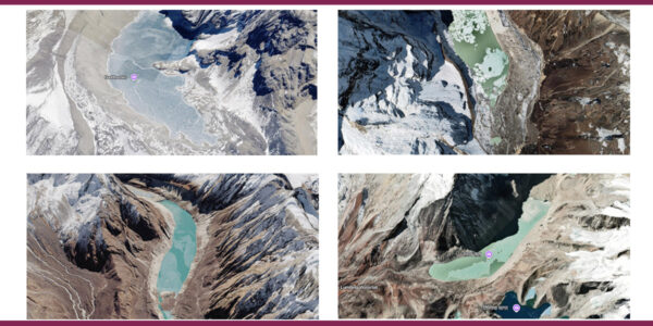
 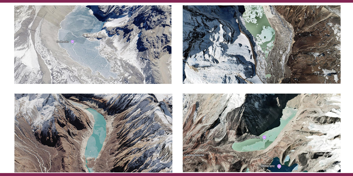 This combo photo shows Google Earth screenshots of (clockwise from top left) Hongu II, Lower Barun, Thulagi and Lumding glacial lakes.
KATHMANDU: The government is implementing a $50 million climate project to lower water levels in four glacial lakes identified as posing a high risk of glacial lake outburst floods (GLOFs).
The four lakes—Thulagi in Manang, Lower Barun and Hongu II in Sankhuwasabha, and Lumding in Solukhumbu—are among 21 glacial lakes in Nepal identified as potentially dangerous in a 2020 study by the United Nations Development Program (UNDP) and the International Centre for Integrated Mountain Development (ICIMOD).
Learning from the experiences of Tso Rolpa of Dolakha and Imja Tso, where water levels have been reduced by building an outlet channel, the government plans to lower water levels in the four glacial lakes as a preventive measure against potential GLOFs.
The four lakes lie in two major river systems. Thulagi Tsho drains into the Marsyangdi River in the Gandaki River basin, while Lower Barun drains into the Arun River, and Lumding Tsho and Hongu II drain into the Dudhkoshi River in the Saptakoshi basin.
Here we take a look at these four glacial lakes:
Thulagi, Manang
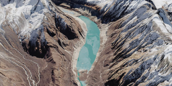
Thulagi is one of three glacial lakes in Nepal where the ICIMOD conducted field investigations into GLOF risks in 2011. It lies at the southwestern foot of Mt Manaslu is drained by Dona Khola, which meets Marshyangdi near Dharapani on the popular Annapurna Circuit trekking trail.
A remote assessment in 2015 found that the lake is susceptible to rockfalls from both of its side slopes, although it is not considered particularly susceptible to avalanches. The study states that the lake’s expansion has largely stalled since 2010, suggesting that it may have reached its maximum spatial extent.
The terminal moraine—the ridge of debris that forms the lake’s natural barrier—has ponds and an outlet channel that has changed over the past 15 years, suggesting that it may contain ice. However, the moraine appears relatively stable based on its slope angle.
A 2018 study by Umesh Haritashya and team measured the lake’s depth at 79 meters and estimated it held 36.1 million cubic meters of water. The study also found that the lake’s surface area and volume have remained almost stable for about two decades.
Lower Barun, Sankhuwasabha
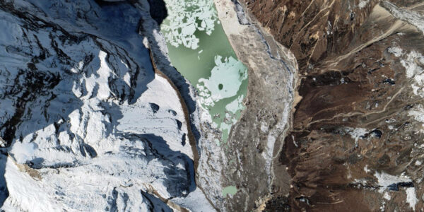
Many studies have identified Lower Barun as one of Nepal’s most dangerous glacial lakes. It has a maximum depth of 205 meters. The lake is located in Makalu Barun National Park, on the upper reaches of the Barun River and adjacent to the Makalu massif.
From 2000 to 2017, the lake area increased by 34% and, over the past three years, Lower Barun Lake has grown by 0.19 sq km, according to the 2018 study by Umesh Haritashya and team.
The lake is particularly vulnerable to rockfalls and avalanches from its southern slope. A smaller glacial lake called Seto Pokhari, located around 4.5 kilometers north of Lower Barun Tsho, also poses a potential upstream GLOF threat.
While the moraine of Seto Pokhari appears relatively stable, satellite imagery indicates ponds on the terminal moraine of Lower Barun Tsho and changes in its outlet. Researchers say these features suggest the presence of an ice-cored moraine.
The combination of an ice-cored moraine and the lake’s susceptibility to dynamic failure has led researchers to classify Lower Barun Tsho as a very high-hazard lake.
Lumding, Solukhumbu
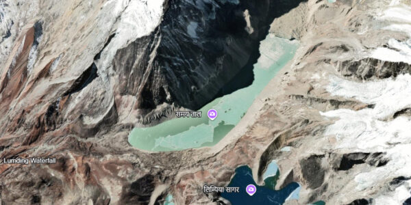
Lumding was classified as a high priority for further investigation by ICIMOD in 2011.
A remote assessment has classified it as a very high-hazard lake because it is vulnerable to both dynamic and self-destructive failures. Multiple studies have shown rockfalls and avalanches from the southern slope could enter the lake.
The lake also faces a potential threat from Lumding Tsho Teng, a smaller lake located about 600 meters upstream. Lumding Tsho Teng covers 0.34 sq km at an elevation of 5,141 meters and is susceptible to a large avalanche from its northeastern slope as well as rockfalls from surrounding slopes.
A 2015 study estimated Lumding’s average depth at 51 meters, maximum depth at 114 meters and total volume at 57.7 million cubic meters.
Hongu II, Sankhuwasabha
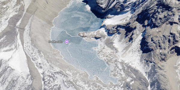
Studies show Hongu II has reached its maximum spatial extent which means further expansion of the lake is not expected to significantly alter its exposure to surrounding hazards.
However, the lake is highly exposed to rockfalls and avalanches from its southern and eastern slopes. The terminal moraine has a slope angle of 18.8 degrees, well above the 10-degree threshold used to indicate greater instability.
According to a 2015 study, mo melt ponds were observed on the moraine, and the outlet appears stable in satellite imagery. This suggests that the lake is unlikely to have an ice-cored moraine.
However, the steep terminal moraine and the likelihood of rockfalls or avalanches entering the lake has led researchers to classify is as a very high-hazard lake.